Securing Sensitive Information: Geospatial Data Protection Strategies for Cybersecurity
- NA
- Jan 30, 2025
- 5 min read

Geospatial data is more than just numbers on a map; it plays a vital role in urban planning, disaster response, and environmental conservation. As this information becomes increasingly essential to various sectors, the need to protect it from cyber threats has never been more critical. Cybersecurity breaches can lead to significant consequences, including data theft, manipulation, or unauthorized access to sensitive information.
In this post, we will discuss effective strategies for safeguarding geospatial data from cyber threats. By putting these security measures into action, organizations can not only protect their information but also foster trust and accountability.
Understanding Geospatial Data Vulnerabilities
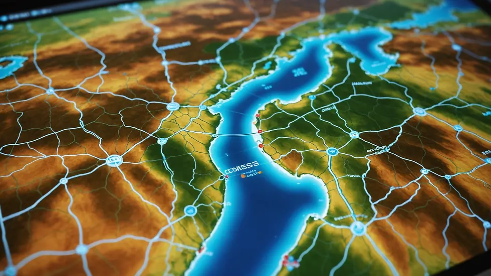
Geospatial data includes a broad spectrum of location-based information such as satellite imagery, GPS coordinates, and maps. Although valuable, this data is susceptible to various cyber threats. For instance, centralized databases where data is aggregated become prime targets for cybercriminals. A 2022 report from Cybersecurity Ventures estimated that globally, cybercrime costs businesses over $6 trillion annually, and geospatial data is not exempt from this trend.
Organizations need to recognize possible attack vectors. For example, phishing attacks targeting GIS professionals can trick them into revealing access credentials. Additionally, unpatched software can serve as a gateway for malware, making it imperative to stay updated and vigilant.
Establishing a Data Security Policy
An effective data security policy is essential for protecting geospatial data. This policy should define clear protocols for how data is managed, stored, and shared.
Key elements of an effective data security policy include:
Access Control: Implement role-based access control (RBAC). This ensures that only authorized personnel can access sensitive data. Studies show that organizations with RBAC see a 45% reduction in unauthorized access incidents.
Data Encryption: Use robust encryption for data both at rest and in transit. Encrypting data ensures that even if a breach occurs, the data remains unreadable to unauthorized users.
Incident Response Plan: A clear and detailed incident response plan for data breaches is vital. This plan should outline notification procedures and steps for remediation, which can significantly reduce the damage and recovery time.
By creating a strong data security policy, organizations can instill accountability in their teams and enhance their overall security posture.

Implementing Technical Safeguards
Technical safeguards are crucial for the protection of geospatial data. Here are some vital measures organizations should implement:
Firewall and Intrusion Detection Systems: Utilizing firewalls along with intrusion detection systems can help monitor data traffic and identify suspicious activities. In 2021, companies with effective firewall systems reported a 30% decrease in successful attacks.
Regular Software Updates: Keep all software current, including GIS applications and databases. Vulnerabilities in outdated software can be easily exploited. A recent survey revealed that 60% of cyberattacks leveraged known vulnerabilities in outdated systems.
Data Backup Solutions: Regularly back up data to mitigate the impact of ransomware attacks or accidental deletions. A successful data backup plan can ensure that critical geospatial information is recoverable.
By embedding these technical safeguards into their security framework, organizations can significantly reduce the chances of cyber threats impacting their geospatial data.
Training Employees on Cybersecurity Best Practices
Employees are often the first line of defense against cyber attacks. Ensuring they are well-trained in cybersecurity is essential to safeguard sensitive data.
Training should cover several key topics:
Phishing Awareness: Equip employees with the skills to identify suspicious emails and links. For example, in 2022, 82% of cyber incidents involved some form of phishing attack.
Secure Data Handling: Train staff on best practices for securely handling sensitive geospatial data. This includes proper methods for disposing of physical documents and secure sharing techniques for digital files.
Incident Reporting: Encourage employees to report suspicious activities promptly. A culture of transparency can lead to quicker identification and mitigation of potential threats.
A knowledgeable workforce can significantly enhance an organization's defense against cyber threats.
Collaboration with Cybersecurity Experts
Organizations managing sensitive geospatial data should seriously consider collaborating with cybersecurity experts. Their insights can provide significant value in strengthening data protection strategies.
Key areas of collaboration may include:
Risk Assessments: Conducting thorough risk assessments can identify vulnerabilities within the organization's current security setup.
Incident Response Planning: Experts can help develop tailored incident response plans that meet the specific challenges and demands of managing geospatial data systems.
Security Audits: Regular security audits ensure that security measures are effective and comply with industry best practices. Organizations that conduct audits bi-annually have reported being 70% more resilient against cyber threats.
Working with cybersecurity professionals can enhance organizations' abilities to prepare for potential cyber incidents.
Embracing Emerging Technologies
As cyber threats grow more sophisticated, organizations must consider adopting innovative technologies to safeguard their geospatial information.
Promising technologies include:
Artificial Intelligence (AI): AI can analyze access patterns to detect anomalies, allowing organizations to react to potential threats proactively.
Blockchain: This technology can offer secure, decentralized data management, which improves the integrity of geospatial data.
Geospatial Data Loss Prevention (DLP) Solutions: DLP tools specifically designed for geospatial data can monitor data flows, preventing unauthorized sharing or access.
Integrating these cutting-edge technologies is critical for maintaining robust security measures against evolving cyber threats.
Regular Security Assessments and Compliance
Conducting regular security assessments and compliance checks is vital for maintaining the integrity of geospatial data protection strategies. This process ensures adherence to industry guidelines while identifying any existing security gaps.
Frameworks and Standards to Consider
A few established frameworks can guide organizations in implementing effective cybersecurity measures, including:
NIST Cybersecurity Framework: This framework provides a structured approach for managing cybersecurity risks applicable across various sectors.
ISO/IEC 27001: This widely recognized standard offers best practices for information security management systems, with an emphasis on continuous improvement.
GDPR Compliance: For organizations managing geospatial data that includes personal information, adherence to the General Data Protection Regulation (GDPR) is essential for legal compliance.
Regularly evaluating security measures against these frameworks supports an ongoing commitment to cybersecurity and helps protect sensitive geospatial data.
Safeguarding Your Future
The protection of geospatial data involves more than just technology; it requires a comprehensive approach that includes policies, procedures, and training efforts. By establishing strong data security policies, implementing technical safeguards, training employees, collaborating with cybersecurity experts, adopting emerging technologies, and conducting regular assessments, organizations can significantly improve their defense against cyber threats.
Data is a crucial asset in today’s digital landscape, and organizations must prioritize cybersecurity measures to maintain the integrity and confidentiality of their geospatial information.
By staying proactive and informed, teams can navigate the complexities of cybersecurity while ensuring their valuable geospatial data remains secure and well-managed.


Comments